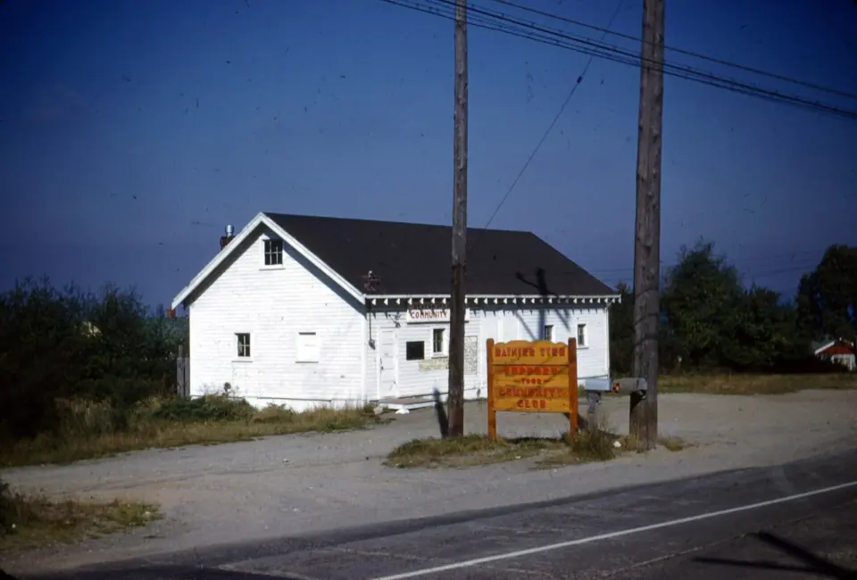
Many people fold Rainier View into the larger Rainier Beach area, which also takes in Dunlap and Pritchard Island. Rainier Avenue South and Renton Avenue South carry you through this part of town. To see how all the city's districts fit together, browse our guide to Seattle neighborhoods.
Walk Lakeridge Park and Taylor Creek
Head to Lakeridge Park first, since it is the reason most visitors come to this corner of Seattle. The land was too steep for homes in the 1800s, so it survived as open space, and today the park protects 35.8 acres of Taylor Creek and Deadhorse Canyon.
A Creek Brought Back by Neighbors
Taylor Creek begins in Deadhorse Canyon, west of Rainier Avenue South near 68th Avenue South, and flows through the park to Lake Washington. It ranks among the four largest streams within urban Seattle, and volunteers have been restoring it since 1971, sometimes with matching grants from the city.
As you follow the trail, you are walking through the results of real hands-on work. Neighbors have planted thousands of native trees and plants, hauled out tons of trash and pulled invasive species. The city helped remove culverts that blocked fish, improved the trails and, in 2010, started a project aimed at better fish passage on the creek.
Wildlife to Watch For
Walk quietly and keep your eyes open for raccoons, opossums and plenty of birds, all common here. A deer has even been seen in the canyon. Look around and you'll see a forest slowly returning to something close to its original state.
Lakeridge Playfield
For a more open spot alongside the wooded ravine, stop by Lakeridge Playfield, also part of the local park mix. Check with Seattle Parks and Recreation for current facilities and any field reservations, and find more green spaces across the city in our Seattle parks guide.
Explore Green Spaces Just North in Rainier Beach
Take a short trip north and the outdoor options multiply. Start with Kubota Garden, the standout, a city historical landmark since 1981. Master gardener Fujitaro Kubota began shaping it in 1927, and his work was interrupted when Japanese Americans were incarcerated during World War II.
Stroll the paths and you'll see Japanese design blended with a Pacific Northwest sensibility. Seattle Parks and Recreation gardeners care for the garden today, along with volunteers and the nonprofit Kubota Garden Foundation, founded in 1990. Mapes Creek runs right through it, and in 1987 the city bought about 17 acres next door to protect the creek's headwaters ravine.
Follow Mapes Creek on to Beer Sheva Park, known for decades as Atlantic City Park. The park and the nearby Atlantic City Boat Ramp put you right on Lake Washington, and Fred Hutchinson Playground and the Deadhorse Canyon Natural Area round out the list.
Discover History You Can Still See
People have lived around this end of Lake Washington since the close of the last ice age. The Xacuabš, or Lake People, had a village on a small island at the lake's southwest shore, and their trail through the valley later became a livestock route, then a rail line, and finally the Rainier Avenue South you drive today.
The Duwamish lost their land under the 1855 Treaty of Point Elliott, and that island was later renamed, ending up as Pritchard Island. When the Lake Washington Ship Canal lowered the lake by about 9 feet in 1917, the island became a peninsula.
Two Surviving Landmarks
Look up to find Emerson School, built in 1909, still standing on a hill above Rainier Beach. Its brick Jacobean design closely matches two other Seattle schools from the same era. In 1914 it hosted the city's first public kindergarten, and baseball figure Fred Hutchinson was among its graduates.
Fire Station 33, also from 1914, is a designated landmark built for one horse-drawn engine. Its single bay floor slopes to ease the horses into a fast start, and the hose tower sits underground. Track down more historic sites with our Seattle landmarks guide.
Community and Daily Life
Rainier Beach, including Rainier View, is one of only two Seattle areas with a Black majority, and many families settled here after being priced out of other neighborhoods. Rainier View Elementary serves local kids and feeds into Rainier Beach High School.
The parks you'll enjoy here depend on residents. Neighborhood stewardship groups work with the city's Department of Neighborhoods and Seattle Parks and Recreation on education and volunteer days.
Getting to Rainier View
Ride Link light rail to the Rainier Beach station, the easiest transit option, just north of the neighborhood. From there, local streets and Rainier Avenue South lead you toward the parks, and it's worth checking Sound Transit for current schedules before you go.
Pair a creek walk with a garden visit and a lakeside stop for a relaxed half day. For more ideas around the city, see our list of things to do in Seattle.