Paradise and the Skyline Trail Loop
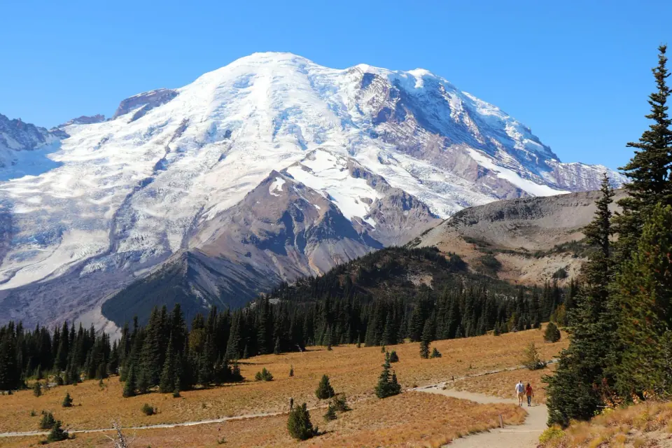
Head to Paradise, the park's busiest hub, for its signature day hike. The Skyline Trail Loop covers roughly 5.5 miles with about 1,450 feet of climbing, a stretch most hikers rate as moderate. You will find the trailhead behind the Jackson Visitor Center, and since the web of connecting paths here can be confusing, grab a map inside before you set off.
Thanks to its southern exposure, Paradise enjoys a longer hiking season than Sunrise. Come in July or August for peak bloom, when the meadows fill with lupine, mountain heather, scarlet paintbrush, asters and bistort. The historic Paradise Inn, opened in 1916, is part of the reason the whole park is now a National Historic Landmark for its rustic 1920s and 1930s architecture.
A shorter turnaround at Glacier Vista
The first 0.4 mile out of the parking lot is the steepest stretch, and after that the grade eases. Climb the stone staircases toward Glacier Vista at about 6,300 feet, a favorite photo stop. Many casual hikers turn back here, so keep going if you want the trail to feel noticeably quieter.
In wildflower season, try a short detour on the west leg of the Waterfall Trail, which climbs through switchbacks lined with lupine. Keep an eye out for hoary marmots grazing right on the path, and give them plenty of space.
Up to Panorama Point and the high route
Beyond Glacier Vista, the trail swings along the Nisqually Glacier and passes the junction where climbers head up toward Camp Muir. A little farther on, Panorama Point sits just under 7,000 feet. On a clear day, take in the Paradise valley, Mount St. Helens, Mount Adams and even Mount Hood from here.
A seasonal pit toilet near Panorama Point is usually closed from about mid-October to mid-June. Past the point, the lower route crosses a steep snowfield that can turn icy. Choose the high Skyline route to the north for steadier footing; it rejoins the lower path after about half a mile.
Heading down past falls and a summit monument
On the descent, the Golden Gate Trail offers a shortcut that trims about a mile, but the full loop rewards you for staying on it. Walk past Sluiskin Falls and the Stevens Van Trump Historic Monument, which honors the first documented ascent of Mount Rainier by P.B. Van Trump and Hazard Stevens in 1870.
Easy family walks at Longmire
Below Paradise, Longmire is the spot for short walks among big trees. Bring the kids here, save it for a rainy day, or use it as a warmup before you head higher.
Trail of the Shadows
Stroll this 0.7-mile self-guided loop around Longmire Meadow in about 20 minutes. Along the way you pass bubbling mineral springs and a replica of an early homestead cabin, in a meadow that deer, birds and beavers call home. Start from the trailhead across the road from the National Park Inn.
Twin Firs Loop
Only 0.4 mile long, this loop is one of the park's finest examples of lowland old-growth forest, winding past huge Douglas-fir, western red cedar and western hemlock. Look for the trailhead on the road between the Nisqually Entrance and Longmire, about 2 miles west of Longmire.
Rampart Ridge and Carter Falls
Ready for more effort? Rampart Ridge climbs steeply through forest and returns on the Wonderland Trail, making a 4.6-mile loop of about 2.5 hours, with viewpoints over Longmire and glimpses of the mountain. Carter Falls is a 2.2-mile roundtrip from across Cougar Rock Campground, and Madcap Falls lies about 100 yards farther.
On the way to Carter Falls, the log footbridge over the Nisqually River can wash out in fall and winter, so check current conditions before you set out.
Sunrise on the north side
Sunrise is the north side's big draw, with heavily visited subalpine meadows much like those at Paradise. Without Paradise's southern exposure, its season runs shorter. Tipsoo Lake is another popular meadow area, and there you are required to stay on trail.
Getting in takes the most planning. For the 2025 season, timed entry reservations were required in the Sunrise corridor every day from July to September, and on weekends and holidays from September to October. The rules have changed from year to year, so confirm the current system before you go.
Carbon River, Mowich and Ohanapecosh
The Carbon River area occupies the park's northwest corner. In 2006 a storm dropped 18 inches of rain in 36 hours and washed out parts of Carbon River Road, which has stayed closed to vehicles ever since. For 2025, the Mowich entrance was also closed after the state barred traffic on the Fairfax Bridge on State Route 165. Ohanapecosh completes the park's suggested hiking areas; check with the park for current trail picks there.
Trail rules that protect the meadows
- Stay on trail. In the Paradise, Sunrise and Tipsoo Lake meadows, it is the law. Everywhere else, steer clear of fragile meadows, lakeshores and stream banks, and choose your lunch spot with care.
- No pets or bikes. Neither is allowed on any park trail.
- Keep groups small. The park recommends day hiking parties of 12 or fewer.
- Do not feed wildlife. Feeding makes animals aggressive, leads to more road collisions and often kills the animals.
- Hike safely. Never hike alone, carry the Ten Essentials and know how to use them, and tell someone your plans.
Planning your hiking day
Trailhead lots fill up, and overflow parking is not allowed, so keep a backup trailhead in mind, since alternatives often have space. In 2025 Paradise returned to first-come, first-served access, which makes an early start your best strategy.
The road to Paradise can also close at the Longmire gate, especially in the colder months. Before you leave, check road status and trail conditions on the National Park Service day hiking page for Mount Rainier. Back in the city, browse more things to do in Seattle, find closer walks in Seattle parks, or plan a stop at notable Seattle landmarks.